DVOA’s BACK TO THE WOODS Orienteering Event
Sanctioned by Orienteering USA
November 6th & 7th, 2021
DVOA is offering the following two-day national event:
DAY 1 Sprints – Bellevue State Park, Wilmington, New Castle County, DE
DAY 1 Middle – Iron Hill Park, Newark, New Castle County DE
DAY 2 Long – Rodney Scout Reservation, North East, Cecil County MD
Registration Opens Saturday September 25th, 2021
Regular Registration - Closes Sunday October 17th, 2021 Midnight ET
Late Fees added to entries after midnight Sunday October 17th, 2021
Late Registration - Closes Monday November 1st, 2021 Midnight ET
Registrations only accepted after November 1st, 2021 with approval email from event registrar.
> Click here to register for the event <> Find out who's registered <
Please note: Because of the ongoing COVID19 pandemic and the risk of exposure to our volunteers and participants, masks are required on all transport busses and indoor areas. All participants and volunteers are also asked to wear masks in common areas where a group must gather. These include check-in, results, finish, and download. We know this is an inconvenience for some, but to be fair to everyone, vaccinated or not, we ask for your cooperation. Please wear a mask to show this simple common courtesy to those in your orienteering community who may be at risk from or have someone at home who is at risk from contracting COVID. Boxes of masks will be available at the event for those who need one.
Please Note: there will be no paper registration packets for this event - all necessary information will be available on the event web site.
Pre-registration required for all recreational courses - Click here to Register
Event Officials
Event Director: Mary Frank
Registrar: Lena Kushleyeva registrar@dvoa.org
OUSA Registration system: Lena Kushleyeva
OUSA Course Consultant:
OUSA Event Consultant:
DAY 1 Bellevue and Iron Hill Course Setter: Tom Overbaugh
DAY 1 Sprint Course Consultant: Dave Cady
DAY 1 Middle Course Consultant: Eric Weyman
DAY 2 Rodney Scout Reservation Course Setter: Wyatt Riley
DAY 2 Course Consultant: Bob Putnam
Vetting: Hugh MacMullan IV, John Campbell, Ralph Tolbert, Nate Orwaschel
Results: Sam Kolins, Lena Kushleyeva
Event Registration/Welcome Table: Patty Carrigan, Ava Suhoki, Dave Morgan
Recreation Registration:
Parking:
Start Master: Tim Walsh
Start Crew: Ed & Judy Scott, Ron Wood, Rob Wilkison, John Ort, Ed Nieman, Steve Aronson, Sharon Siegler
Equipment : Steve Aronson
Finish: Mark Frank
Clothing Return:
Post Race Food / Refreshments:
DVOA webpage/logo design: Bob Gross
Emergency Services:
Park and County Liaison: Mary Frank
Awards: Mary Frank
Event Photographers: Julie Keim and Bob Gross
DVOA Treasurer: John Ort
Schedule
Please Note: there will be no paper registration packets for this event - all necessary information will be available on the event web site.
Saturday November 6, 2021
Bellevue State Park (sprints)
Download a printable park pass for vehicle dashboards
9:00 am - Sprint pre-start
9:30 am - 10:30 am Sprint competitive starts
11:30 am - Sprint courses close
11:30 am - 1:00 pm time for transition from Bellevue to Iron Hill parking, bus to IH start (it is about a 30 minute drive between Bellevue and Iron Hill)
Directions from Bellevue to Iron Hill parking
All participants are urged to use Interstate 495 to travel from Bellevue to Iron Hill. Interstate 95 in Wilmington is undergoing major construction with lane closures and lengthy delays.Exit the park turning left on Carr Rd. At the first light, turn left on Marsh Rd. Follow Marsh Rd. south until it ends at a tee with Edgemoor Rd. Turn left on Edgemoor Rd. and follow SE to the I-495 interchange. Take I-495 south towards Newark. I-495 eventually merges with I-95 south. Take I-95 south to the Rt. 896 interchange. Take 896 South exit (not North or you will end up in UD football traffic) and follow to the first traffic light at Old Baltimore Pike. Turn right on Old Baltimore Pike and travel 1.3 miles southwest to Praise Assembly Church on the right (just past Iron Hill Park). Praise Assembly will serve as the offsite parking lot/bus pick-up point for the Iron Hill Middle event.
PLEASE NOTE: The remote parking area for the Iron Hill Middle is very close to the park. Participants might be tempted to walk along Old Baltimore Pike or Whittaker Rd. to reach the park, bypassing the bus ride. We want to be very clear that this is not permitted. Should someone decide they wanted to walk/run to Start, could jeopardize our event since there may be an official from the County observing the event. (Traffic along Old Baltimore Pike is heavy and travels at high speeds. There is no shoulder on Whittaker Rd. and there are no lines of sight around bends which deems this unsafe even for our buses.) Safety of participants is our highest priority. All participants must take the (full size) bus for transit between the remote parking area and Iron Hill Park. Should you have an issue with this, please contact the Event Director. Thank you.
Iron Hill Park (middle)
1:30 - 2:30 pm White/Yellow Recreational Starts (pre-registration required)
1:00 pm - Middle pre-start
1:30 pm - 2:30 pm Middle competitive starts
4:30 pm - Middle courses close
Sunday, November 7, 2021,
NOTE: Remember to turn your clocks back 1 hour for Sunday morning.
Rodney Scout Reservation (long)
8:30 am Long pre-start
9:00 am - 11:00 am Long competitive starts
2:30 pm Long courses close
Noon: Recreational courses (pre-registration)
– Beginner(WHITE), Adv Beginner(YELLOW)
2pm or as soon as possible Award Ceremony - Day 2 event site.
Registration
Late fees will be added to entries after midnight, Sunday, October 17th, 2021
* Late entries for all competitors after November 1st, 2021 will be accepted only subject to map availability
* After November 1st, 2021 and before registering, email the Registrar to check if maps are still available for your courses.
Event Refunds:Refunds requested by email to registrar on or prior to midnight ET October 20th, 2021 will be a full refund less 10% of the total entry fee for processing. There is no refund after midnight ET October 20th, 2021.
By midnight Sunday 10/17, 2021
By midnight Monday 11/1, 2021
OUSA Discount (Competition Courses Only)
Recreational
By midnight Monday 11/1, 2021ADULT: Day 1
Sprint$22
$32
-$4
No Rec Sprints
Day 1
Middle$34
$44
-$4
$10/map
Day 2
Long$34
$44
-$4
$10/map
JUNIOR: (under 21) Day 1
Sprint$14
$24
-$2
No Rec Sprints
Day 1
Middle$14
$24
-$2
$5/map
Day 2
Long$14
$24
-$2
$5/map
E-punch Rental: $3 per race for competitors; For Recreational participants the rental fee is built into the per map fee. $40 if not returned
Recreational Courses
Pre-registration required for all recreational courses - Click here to Register
Contact the registrar if you plan to bring a group of Scouts, JROTC, or any other group of five or more needing multiple maps. We will have an easier, more streamlined registration process available for you.
Adults: $10 per map, Juniors (20 years and younger) $5 per map.
Saturday November 6, 2021
Start times are 1:30pm – 2:30.
Courses – WHITE-REC, YELLOW-RECSunday November 7, 2021
Start times are 10:30am – Noon
Courses – WHITE-REC, YELLOW-REC
Awards
The awards for Saturday and Sunday will be awarded at the Rodney Scout Reservation Event site at 2pm (or sooner, if possible).
Class/Course Structures
Classes are assigned to the following courses according to the following table:
Competitive Courses
White
Yellow
Orange
BrownY
BrownX
GreenY
GreenX
Red
Blue
F-10
M-10
F-12
M-12
M/F-WhiteF-14
M-14
F-Yellow
M-YellowF-16
M-16
F-Orange
M-OrangeF70+
F75+
F80+
F85+
M80+
M85+
F-Brown
M-BrownF-18
F55+
F60+
F65+
M65+
M70+
M75+
F-20
F35+
F40+
F45+
F50+
F-GreenM-18
M50+
M55+
M60+
M-GreenF-21+
M-20
M35+
M40+
M45+
M-RedM-21+
Non-Competitive Courses/Classes
White Yellow
White-REC Yellow-REC
Your age is defined as the actual age you will be as of 12 /31 / 2021
F-10 = female 10 years of age and under
M75+ = Male 75 years or older
F-Orange = Female of any age
Map & Course Notes
SI Air will be activated for this event with the exception of the Start boxes. All participants must punch the Start box to provide a record of their start time. All controls and Finish boxes will have SI Air mode activated. If you do not have an SI Air finger stick, you must punch the Start box, all controls and the Finish box.
Bellevue State Park

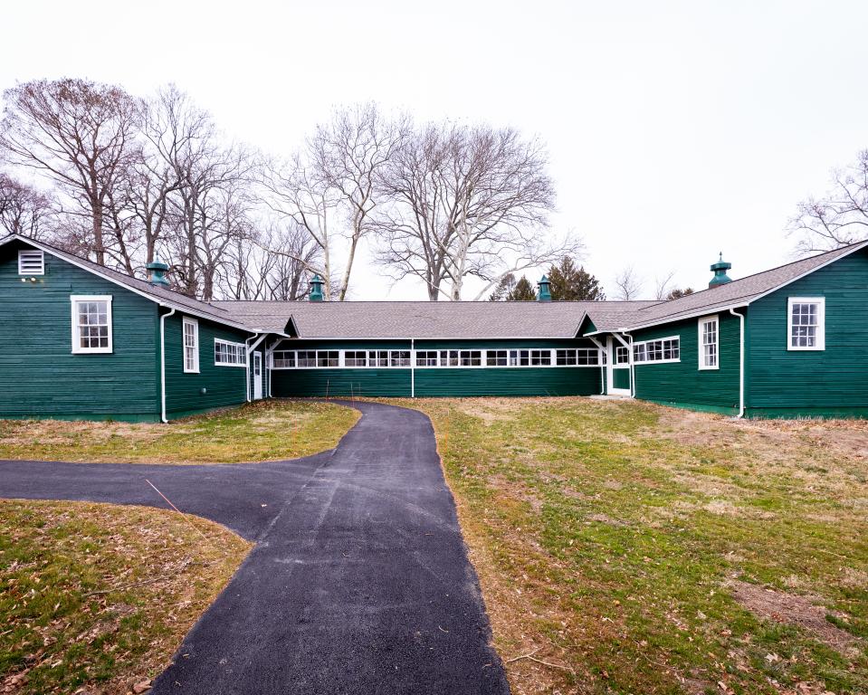


Bellevue History: The lands which comprise the bulk of Bellevue State Park were originally the estate of a wealthy wool merchant, Hanson Robinson. In 1855, Robinson built a Gothic Revival castle as the centerpiece of his property and named it Woolton Hall. The dark stone castle was outfitted with several towers that allowed Robinson to get a scenic view of the Delaware River. In 1893, William du Pont Sr. purchased the estate. Upon his death in 1928, the estate was inherited by his son, William du Pont Jr. du Pont remodeled Woolton Hall so that it was a replica of Montpelier, the former residence of President James Madison which had also been du Pont's boyhood home. The home was renamed Bellevue Hall.
Wiliam du Pont Jr. was married to equestrian Jean Liseter Austin until 1941, and married to tennis professional Margaret Osborne duPont from 1947 to 1964. While married to his first wife, du Pont greatly expanded the horse facilities at Bellevue, including building two indoor tracks and an outdoor track. During his marriage to Osborne, they built additional recreational facilities, including a swimming pool and both an indoor and outdoor tennis court. Osborne duPont had an accomplished tennis career, competing in singles, doubles and mixed doubles. She earned 25 US titles, 7 Wimbledon titles and 5 French titles.
Following du Pont's death in 1965, his children had no interest in maintaining ownership of the estate with all of its recreational facilities. The estate was purchased by the state of Delaware in 1976 and opened to the public as Bellevue State Park.
Bellevue Terrain: Relatively flat, open area covering grounds of former estate of William du Pont, Jr. Some pockets of woodlands as well.
Bellevue Map:
Scale: 1:4000
Contour Interval: 2.5m
Base Map: Matthew Robbins, Petr Hartman (LIDAR)
Fieldwork & Drafting: Vladimir Zherdev - 2020Courses Day 1 Sprints
Course Setter: Tom Overbaugh
Course Length (km) Climb (m) Controls White 1.50 15 11 Yellow 1.60 13 11 Orange 1.80 15 12 Brown X 1.90 18 13 Brown Y 1.50 13 11 Green X 2.10 15 15 Green Y 2.00 18 14 Red 2.90 20 20 Blue 3.10 30 20
Bellevue Course Setter Notes
For the Sprint stage of the Back to the Woods National Ranking Event, DVOA will debut a new map of Bellevue State Park. Below are Course Setter Notes for the race.
Orienteering History at Bellevue
This event will mark the first use of Bellevue State Park for orienteering. In addition to Bellevue State Park, the new map also includes two adjacent venues: Bringhurst Woods Park and Rockwood Park. Only the Bellevue portion of the map will be used for this event. Bringhurst Woods and Rockwood Parks will be used for future local events.There is an interesting historical tie between Bellevue and another popular DVOA orienteering venue: Fair Hill. Both Bellevue and Fair Hill are on land formerly owned by William duPont Jr.
Event Logistics
Participants traveling to the park from the south are urged to use I-495 (not I-95) and Marsh Rd. to reach the park entrance on Carr Rd. Interstate 95 in Wilmington is undergoing major construction with lane closures and lengthy delays. All participants traveling south to Iron Hill following the Bellevue event should use I-495 to avoid the I-95 construction.In lieu of the park entry fee ($8 per vehicle out-of-state), dashboard signs are provided on the event web page and will also be available at Check-in. Please place the sign on your vehicle dashboard to avoid being ticketed. The park entry fee is covered as part of the event registration fee.
There is ample parking at Bellevue. The speed limit on park roads is 15 mph. Check-in will be located at a tent adjacent to the parking lot. Start is also directly adjacent to the parking lot. Warm-up will be on a portion of the gravel track just north of Check-in - follow signs. Note that only the designated portion of the track is available for warm-ups, not the full track. All other areas are off-limits. Restrooms are available adjacent to Check-in.
If you have clothing or other gear you would like transported from the Start to the Finish area, please place it in a plastic bag with your name on it and leave at the Start. Because of the short duration of the race, we cannot guarantee that your gear will arrive at the Finish before you.
Loose control descriptions will be available at the Start.
Race bibs are not being provided for this event. Participants should write their initials or name on the back of their map to allow for reclaiming any maps collected at the Finish. Hand sanitizer will be available at the Start.
SI Air will be activated for this event with the exception of the Start boxes. All participants must punch the Start box to provide a record of their start time. All controls and Finish boxes will have SI Air mode activated. If you do not have an SI Air finger stick, you must punch the Start box, all controls and the Finish box.
Start will consist of three call-up lines. The third call-up line is the Start triangle.
If you are required to surrender your map at the Finish, a clothesline with clothespins will be provided to prevent intermingling of maps. Please clip your map to the clothesline as directed by the Finish crew. Results will be located a short walk from the Finish in a pavilion. After finishing their race, participants are encouraged to spectate - multiple controls will be visible from the Finish arena. There is an approximate 5 minute walk from the Finish arena back to the parking lot. A porta-john will be available at the Finish arena.
Map Notes
The map was field-checked by Vladimir Zherdev in 2020. Minor updates were completed in 2021 by Tom Overbaugh. Map scale for all courses is 1:4000. Contour interval is 2.5 meters. The map is produced to ISSprOM standards.Boulders 0.5 meters high and above are mapped. Rootstocks 1.5 meter and above are mapped. Rootstocks are shown with a brown "x" which is a non-IOF symbol.
Black ">" or "<" symbols (symbol 203) are used to designate culverts for minor water drainage beneath trails or roadways.
Course Notes
Course time limit is 1 hour. Expected winning time for all courses is in the 10-15 minute range.The area immediately surrounding Bellevue Hall and its associated formal gardens is off-limits for this event and is marked with red out-of-bounds cross-hatching on the map. Courses have been designed so that there would be no advantage for a competitor to enter this area.
The Green X course uses a black "o" for control description. The feature is a bird house on an elevated pole.
The Red and Blue courses both use a black "x" for control description. The feature is a physical fitness station. The Red and Blue courses also both use a black "o" for control description. The feature is an information signboard.
As part of the COVID-19 risk management measures, no water will be provided at the Start, on the course or at the Finish. Participants should bring their own water.
Many thanks to Dave Cady for serving as OUSA Course Consultant and especially for his responsiveness when the park imposed late restrictions requiring significant redesign of all courses.
Tom Overbaugh
Sprint Course Setter
Iron Hill Park

Iron Hill History: Iron Hill was an important source of jasper used by Native Americans for arrowheads and tools as early as 2000 BC. The location was first referred to in print on Augustine Herman's 1670 map of Virginia and Maryland, where it was labeled "Yron Hill". In 1701, the hill was included in the 30,000-acre (12,000 ha) Welsh Tract, granted by William Penn to a group of settlers fleeing religious persecution in Wales. The Welsh settlers were familiar with ironworking and mining techniques, and soon commenced open-pit mining operations on Iron Hill.
During the Revolutionary War, Iron Hill and the surrounding area were the site of the Battle of Cooch's Bridge (also known as the Battle of Iron Hill) in September 1777. George Washington ascended the hill to observe enemy troop movements prior to the battle. Mining on Iron Hill continued until the late 19th century, though extraction of the low-grade ore proved minimally profitable and many of the ventures ended in bankruptcy. The last mining operation on Iron Hill was run by J.P. Whitaker, who shipped the ore to Principio Furnace in Maryland for smelting. African-American mine workers and their descendants continued to inhabit the area and, in 1923, Pierre S. du Pont funded the construction of Iron Hill School No. 112C to serve this population. The school remained in operation until Delaware public schools were desegregated in 1965 and now is part of the Iron Hill Museum.
The Iron Hill Science Center opened to the public in 2016 and houses exhibits which include paleontology (fossils), geology (rocks and minerals), taxidermy of mammals, fish, and birds, botany (plants), and conchology (shells).
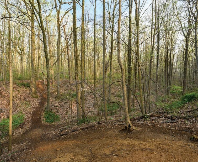
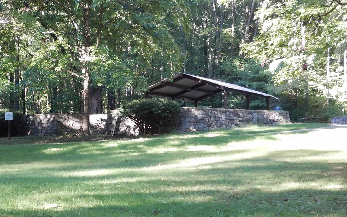
Iron Hill Terrain: Broad hillside with mostly open woods and moderate to dense trail network. Significant detail in the form of boulders, pits and quarries (from past mining operations).
Iron Hill Map:
Scale: 1:7500 Brown X, Brown Y, Green X, Green Y courses,
1:10,000 All other courses
Contour Interval: 5m
Base Map: Ivar Helgesen (photogrammetry)
Fieldwork & Drafting: Vladimir Zherdev, Eric Weyman (2020-2021)Download Iron Hill Warm-up Map (1-7,500)
Download Iron Hill Warm-up Map (1-10,000)
Courses Day 1 Middle
Course Setter: Tom Overbaugh
Course Length (km) Climb (m) Controls White 2.40 45 11 Yellow 2.50 65 10 Orange 2.90 75 11 Brown X 2.60 65 11 Brown Y 2.20 50 8 Green X 3.30 75 13 Green Y 2.90 85 12 Red 3.60 100 15 Blue 4.30 110 17
Iron Hill Course Setter Notes
Orienteering returns to Iron Hill after an extended absence with the Middle Distance stage of the Back to the Woods National Ranking Event. Below are Course Setter Notes for the race.
Orienteering History at Iron Hill
The original Iron Hill map was produced in 1997. In 1999, Iron Hill was the site for the United States Short Course championships. DVOA local events were held at the park for many years until 2007 when the map was mothballed while several major construction projects were completed at the park: a new entry road off of Old Baltimore Pike, the Iron Hill Science Center, and an 18-hole disc golf course. The disc golf course is rated among the top 20 in the country and is host to professional disc golf events.
Event Logistics
Due to limited parking at the park, an off-site parking area will be used with busing:Praise Assembly Church
1421 S. Old Baltimore Pike
Newark, DE 19702The church parking lot is less than 1 km southwest of the park so the bus ride will be quite short. Note that there are no restroom facilities at the church parking area. Porta-johns will be available at the Bus Drop /Check-in location in a parking lot adjacent to the Start area. Walk to the Start from the Bus Drop will take only 1-2 minutes.
Warm-up maps at both 1:7500 and 1:10,000 scale will be available on the event website for download. If printing from the website, ensure zoom level is set at 100% to ensure scale is correct. Copies will also be available at Check-in. The warm-up area was last field-checked in 2019. (no 2021 updates). Warm-up is in the woods west of the parking lot and the woods south of the internal park road. Woods east of the parking lot and north of the internal park road are off-limits.
If you have clothing or other gear you would like transported from the Start to the Finish area, please place it in a plastic bag with your name on it and leave at the Start.
Loose control descriptions will be available at the Start.
Race bibs are not being provided for this event. Participants should write their initials or name on the back of their map to allow for reclaiming any maps collected at the Finish. Hand sanitizer will be available at the Start.
SI Air will be activated for this event with the exception of the Start boxes. All participants must punch the Start box to provide a record of their start time. All controls and Finish boxes will have SI Air mode activated. If you do not have an SI Air finger stick, you must punch the Start box, all controls and the Finish box.
Start will consist of three call-up lines. The third call-up line is the Start triangle.
If you are required to surrender your map at the Finish, a clothesline with clothespins will be provided to prevent intermingling of maps. Please clip your map to the clothesline as directed by the Finish crew.
Results will be located a short walk from the Finish area. The bus will pick up participants from the Results area at the conclusion of the race for return to the off-site parking area.
Map Notes
The updated version of the map was field-checked by Vladimir Zherdev in 2019 with a second pass by Eric Weyman in 2020. Eric also made more recent minor updates competed in October 2021. Map scale for the Brown X, Brown Y, Green X and Green Y courses is 1:7500. Map scale for all other courses is 1:10,000. Contour interval is 5 meters.The disc golf course will be closed during the race. Most courses cross through the disc golf area. The tees consist of small concrete pads. Targets are metal baskets shown on the map with a black "o" (symbol 530 - prominent man-made feature). Fairways are cleared of brush and some edges are therefore mapped with a distinct vegetation boundary symbol. For the entire Iron Hill map, all vegetation boundaries are shown using the green dash symbol (symbol 416). This symbol was chosen to minimize confusion with boulders and rocky ground. A map sample showing the green dash vegetation boundary and typical disc golf elements is shown below:
Boulders 0.5 meters high and above are mapped. Rootstocks 1.5 meter and above are mapped. Rootstocks are shown with a brown "x" which is a non-IOF symbol.
A copy of the old version of the Iron Hill orienteering map is available here.
Course Notes
Course time limit is 2 hours. Expected winning time for all courses is in the 20-30 minute range. This is in accordance with the OUSA Rules for multiple courses run on the same day (Sprint, Middle).Multiple courses use a black "o" for control description (symbol 530 - prominent man-made feature). The feature is a disc golf target basket. The White course uses a black "x" for one control description (symbol 531 - prominent man-made feature). The feature is a trailhead information board.
Special note regarding disc golf target baskets: the disc golf target locations shown on the map were accurate as of early October 2021. Because the disc golf course is set-up to allow for multiple pin locations, it is possible that some of the basket locations may have shifted and are no longer consistent with the mapped location. Any disc golf targets used as control features are shown in the correct location on the map.
As part of the COVID-19 risk management measures, no water will be provided at the Start, on the course or at the Finish. Participants should bring their own water.
I would like to express my sincere thanks to Eric Weyman for performing second pass mapping and for his diligent and detailed review of the courses as OUSA course consultant.
Tom Overbaugh
Middle Course Setter
Rodney Scout Reservation
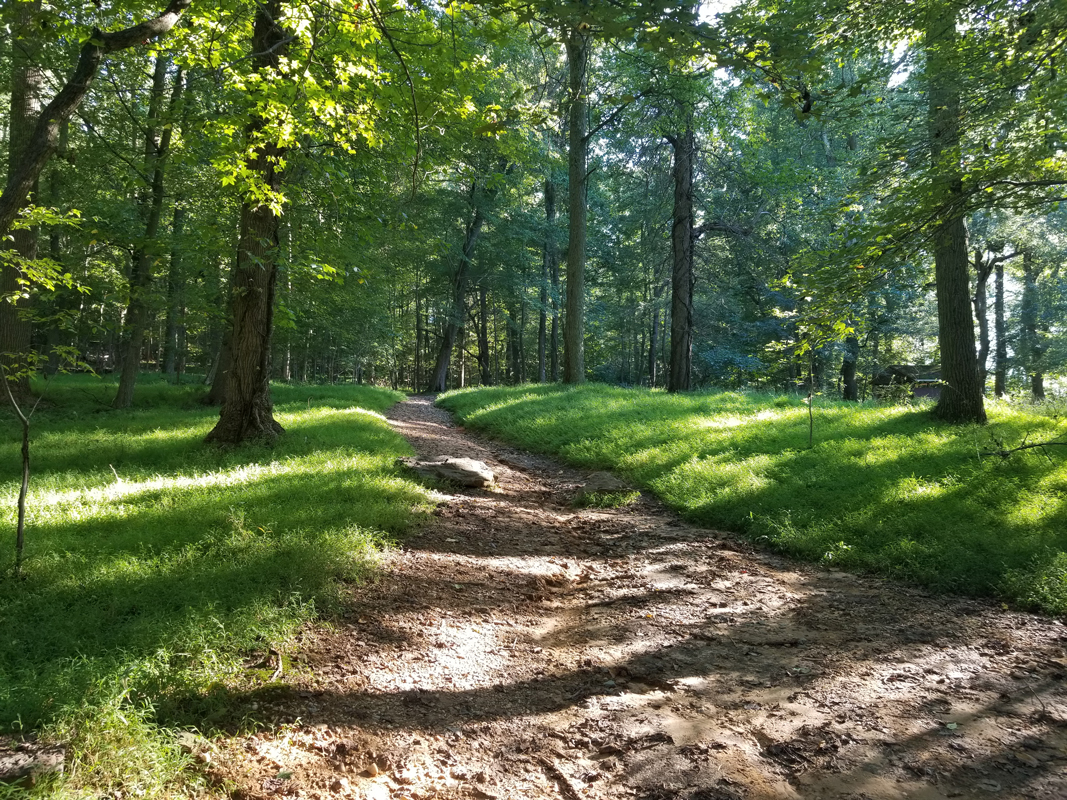
Rodney Scout Reservation Terrain: Mix of a few medium hills and flatter areas with a mix of white to medium green forest, light to dense trail network, moderate contour detail, and dozens of scout related buildings.
Rodney Scout Reservation Map: Scale: 1:10,000
Contour Interval: 5m
Base Map: Greg Balter
Fieldwork & Drafting: Vladimir Zherdev (2018), and event updates Wyatt Riley (2020-2021)Courses Day 2 Long
Course Setter: Wyatt Riley
Course Length (km) Climb (m) Controls White 2.20 50 10 Yellow 2.70 115 11 Orange 4.30 175 11 Brown X 3.90 140 12 Brown Y 3.60 150 11 Green X 6.80 255 14 Green Y 5.80 225 13 Red 8.10 295 17 Blue 10.90 430 20
Map Notes
Rootstocks are intermittently mapped. Rootstocks that are on the map are generally distinct, and large (2+ meters) - but there are also several other rootstocks, also often large (2-4m) that are not shown on the map.Old Trails & Roads - Rides, Indistinct Trails, Linear Marshes and Ditches
- There are several parts of the map where there was clearly much more use in the past few decades than more recently. What was once a clearly graded dirt road or a major trail may have aged substantially.
- Indistinct trails generally have some runnable utility vs. the nearby terrain, but may be difficult to notice when crossing, (or even following at times) and may not have consistently good runnability.
- In the eastern part of the map especially, the most indistinct trails are sometimes invisible on the ground - but do have white metal blazes nailed to trees that are useful for navigation.
- Rides generally represent old graded dirt roads, visible in the land-form, that have runnability usually no better than the nearby forest.
- Ditches are sometimes old eroded trails (especially when connected to another trail feature) where the dominant terrain feature is now a ditch - with correspondingly limited runnability.
- In some cases these old roads or trails are in wet areas, and have become linear marshes, or intermittent streams.
- On Yellow, there's a trail along a ridge line that is mapped as major, but with recent fallen trees appears indistinct in places. If you're on the ridge top, and there's at least an intermittently distinct trail (and eventually a fence nearby), you're in the right place.
Vegetation
- With the warm fall, the forest still has a few more leaves than is typical in early November, especially the pawpaw, but for the most part, the forest has become a lot higher visibility than even a week ago.
- Most vegetation changes mapped are rather soft - quite useful for runnability and route choice but only occasionally for precise navigation.
- Professional mapping of the vegetation is 3 years old, and pre-event vegetation updates have been focussed mostly near control circles.
Course Setter's Notes
Criss-crossing lines
- Scout land vs. adjacent parkland with limited permission resulted in courses that are somewhat more compactly set in the northern part of the mapped area than you might expect.
- Some courses have 1 or more criss-crossing lines - check your lines carefully, as well as which control # you are heading for.
- Orange & Green Y have 1 each.
- Green X & Red have 2.
- Blue has 6.
Check your codes
- With 9 different courses, there can sometimes be a control near yours, that isn't yours - as usual, check your codes to not mispunch.
Slippery Slopes
- The terrain is for the most part flattish to gently sloping, with good footing.
- Exceptions are:
- Some reentrant bottoms - the sharper ones on the map - may have some fairly steep sides.
- The western edge of the map has a steep hillside that has parts mapped with contour lines, which arguably should be mapped as earthbanks.
- In general, keep your eyes up to look for a flattish way up or down, and avoiding the steepest slopes, and you should be okay.
- The weather leading up to the event is relatively dry, so slick hard mud under leaves hit by two control setters on Thursday, should firm up somewhat by Sunday.
Shooting Range
- The shooting range on site
- Is closed this whole week.
- Is marked out of bounds anyway - do not cross this area - it's not on the best route anyway, and has an old rusty barbed wired fence around it.
- There's also no hunting allowed on the property on weekends.
Scouts
- This is an active scout camp - on a busy weekend this summer I came across over 200 scouts & leaders - and there are plenty of buildings, big and small - generally mapped well.
- There's one brand new pavilion about 50 meters west of #67, mostly likely to be noticed only by Orange competitors (or some advanced orienteers slightly off the best route) - that is not on the map.
- This weekend there will be about 10 Scout groups - please say hi to our scout leader hosts, and likely future competitors - and avoid stepping directly on their camp gear. (Running nearby enough to a camp group to not lose time on your route is generally fine - there are a lot of other scouts running around doing the same.)
Water Stops
- If you prefer to carry your own water, please do so.
- As an option
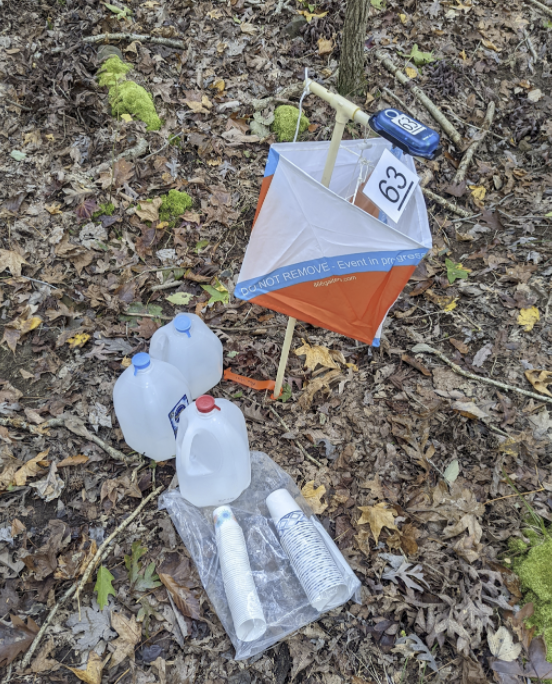
- There is water near controls on the many courses - White/Yellow have none, Orange has 1, and Advanced courses have 2-3.
- These are in the form of cups & gallon jugs - see the photo.
- Please put used cups in the provided trash bag (hard to see, but it's folded in the photo below) - or carry them back to the finish with you.
Accommodations
Comfort Inn & Suites, in Northeast, MD (1 Center Drive, Northeast, MD), Camp Rodney
$105 Single/$110 Double plus tax-Rate until 10/29.
Code:LM11W6, good until 10/29
phone: 410.287.7100 (pool closed)
online: https://www.choicehotels.com/reservations/groups/LM11W6Ramada by Wyndam, in Newark DE (260 Chapman Road, Newark DE)
$90 Double/Single plus tax
Code: DVOA for rate until 10/22. (limited rooms, football weekend).
phone: 302.738.3400 or
online: https://www.wyndhamhotels.com/ramada/newark-delaware/ramada-newark-wilmington-area/rooms-rates?&checkInDate=11/05/2021&checkOutDate=11/07/2021&groupCode=CGDOVA
SI-Card Rental
SI card rental is available for $3 per race with a $40 replacement fee if not returned.
SI Air will be activated for this event with the exception of the Start boxes. All participants must punch the Start box to provide a record of their start time. All controls and Finish boxes will have SI Air mode activated. If you do not have an SI Air finger stick, you must punch the Start box, all controls and the Finish box.
Other
Alcoholic beverages
Alcoholic beverages are prohibited at the event sites.Dogs
Per OUSA ‘Rules for Foot Orienteering Events’, Section A.33.9, “Competitors shall not have any animals accompanying them on the course. Additionally, in order to ensure the safety of the competitors, and to avoid any possible distractions, dogs are prohibited from the Start and Finish areas, and from the arena”.
Walk to Start
Day 1 Sprints - 1-2 minutes
Day 1 Middle - 1-2 minutes (from bus drop)
Day 2 Long - 50-200m (depending on where you park).Port-O-Johns:
Day 1 Sprints - Port-O-Johns will be located near Registration/Finish and one will be located near Start
Day 1 Middle - Port-O-Johns will be located near Registration/Finish and one will be located near Start
Day 2 Long - Port-O-Johns will be located near Registration/Finish and one will be located near Start
Directions to Event Parking
Saturday - Bellevue:
Download a printable park pass for vehicle dashboards
From north, take I-95 south to Marsh Rd. exit. Go south on Marsh Rd. to intersection with Carr Rd. Take a left on Carr Rd. Park entrance is ahead on right.
From south: participants are urged to use I-495 rather than I-95 due to major road construction in Wilmington. Take I-495 north to Exit 4 US-13/DE-3/Edgemoor Rd. Turn right onto Edgemoor Rd. and follow for 0.8 mile. At light, turn slight right onto Marsh Rd. Follow Marsh Rd. 1.3 miles to intersection with Carr Rd. Take a right on Carr Rd. - park entrance is ahead on right.
Saturday - Directions from Bellevue to Iron Hill parking
All participants are urged to use Interstate 495 to travel from Bellevue to Iron Hill. Interstate 95 in Wilmington is undergoing major construction with lane closures and lengthy delays.
Exit the park turning left on Carr Rd. At the first light, turn left on Marsh Rd. Follow Marsh Rd. south until it ends at a tee with Edgemoor Rd. Turn left on Edgemoor Rd. and follow SE to the I-495 interchange. Take I-495 south towards Newark. I-495 eventually merges with I-95 south. Take I-95 south to the Rt. 896 interchange. Take 896 South exit (not North or you will end up in UD football traffic) and follow to the first traffic light at Old Baltimore Pike. Turn right on Old Baltimore Pike and travel 1.3 miles southwest to Praise Assembly Church on the right (just past Iron Hill Park). Praise Assembly will serve as the offsite parking lot/bus pick-up point for the Iron Hill Middle event.
Sunday:
The camp is approximately 30 miles southwest of Wilmington, DE and 50 miles northeast of Baltimore, MD. Take Exit 100 off I-95, follow Rt. 272 for 10 miles south, through the town of North East and look for signs


